More permanent prairie planned north of Todd Park in Austin
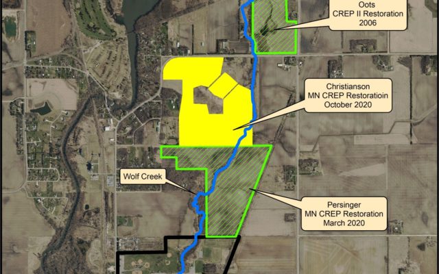
Native prairie grasses, flowers and trees soon will permanently cover 104 acres of cropland along Wolf Creek just upstream from Austin’s Todd Park, where rainbow trout were stocked earlier this year.
Permanently restoring the land – an area the size of 79 football fields – will improve water quality and wildlife habitat through conservation easements that keep the land under private ownership, said James Fett, a Mower SWCD district technician who oversees MN CREP enrollments in Mower County.
In March 2020, Steve and Diane Persinger finalized with Mower SWCD an agreement to enroll their 100-acre parcel in MN CREP, which borders the Christianson land to the south.
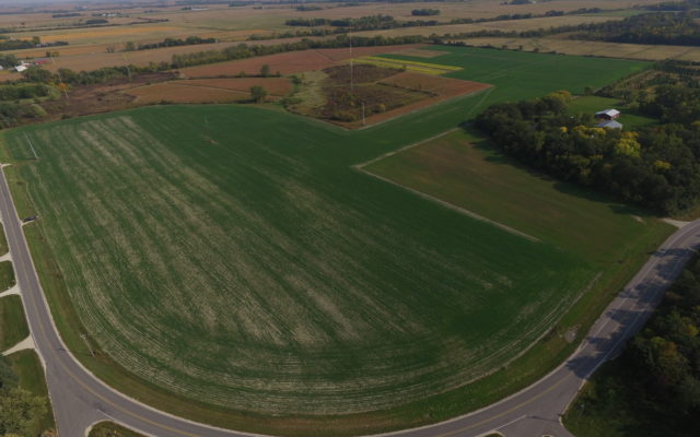
The Persinger parcel – also private property – is on both sides of Wolf Creek, just upstream from where it flows into Todd Park – Austin’s largest park on the city’s northeast edge. This summer, crews worked on the Persinger parcel to create wetlands and seed the land for native prairie.
Together with the Christianson parcel, the 204 acres of future, permanent prairie and wetlands will help protect water quality and reduce flooding of Wolf Creek, a tributary of the Cedar River State Water Trail, Fett said.
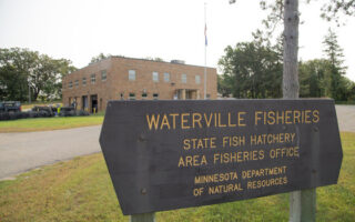
Wolf Creek experienced a busy year of shoreline anglers at Todd Park seeking to reel in some of the 900 rainbow trout stocked in the stream this spring by the Minnesota Department of Natural Resources’ fisheries division from Waterville.
It’s part of a new “catch-and-take” fishery that ended its season in September; DNR plans to stock a similar number of rainbow trout in spring 2021 in Wolf Creek.
Fett also is connected with the Wolf Creek trout fishery. He made a request in 2019 to the DNR to consider stocking trout in Wolf, which he measured in 2017 and 2018 for water-temperature data at an unshaded part of the stream in Todd Park.
Wolf Creek now is Mower County’s only stream stocked by DNR for trout.
As for MN CREP, Mower County now has seven finalized easements through program, totaling about 347 acres of marginal cropland put into permanent restoration for native prairie and wetlands. About 331 of those acres are in the Cedar River Watershed.
Created in 2017, MN CREP is a voluntary program focused on marginal cropland that is flood-prone or erosive. It aims to protect and restore up to 60,000 acres across 54 southern and western Minnesota counties, including Mower, by using vegetative buffer strips, wetland restoration and drinking water wellhead protection.
Landowners accepted into MN CREP enroll in the federal USDA’s Conservation Reserve Program (CRP) for 14 to 15 years. At the same time, the land is put into a permanent conservation easement through the state’s Reinvest In Minnesota (RIM).
Mower SWCD works on MN CREP enrollments with the USDA’s Farm Service Agency (FSA) and Natural Resources Conservation Service (NRCS) along with the Minnesota Board of Water & Soil Resources (BWSR).
MN CREP pays landowners $7,000 to $8,000 per acre and covers all costs for restoring the land.
Typically, MN CREP restorations involve restoring hydrology through tile breaks, tile blocks, scrapes, embankment construction and daylighting tiles, among other practices. The site is seeded with a highly diverse mixture of native grasses and forbs beneficial to wildlife and pollinator habitat. That also prevents erosion and filters surface and groundwater.
Mower County landowners interested in MN CREP should contact James Fett, Mower SWCD, at 507-434-2603, ext. 5, or by email at [email protected].
Related Content

You Might Also Like